Drone Remote Sensing
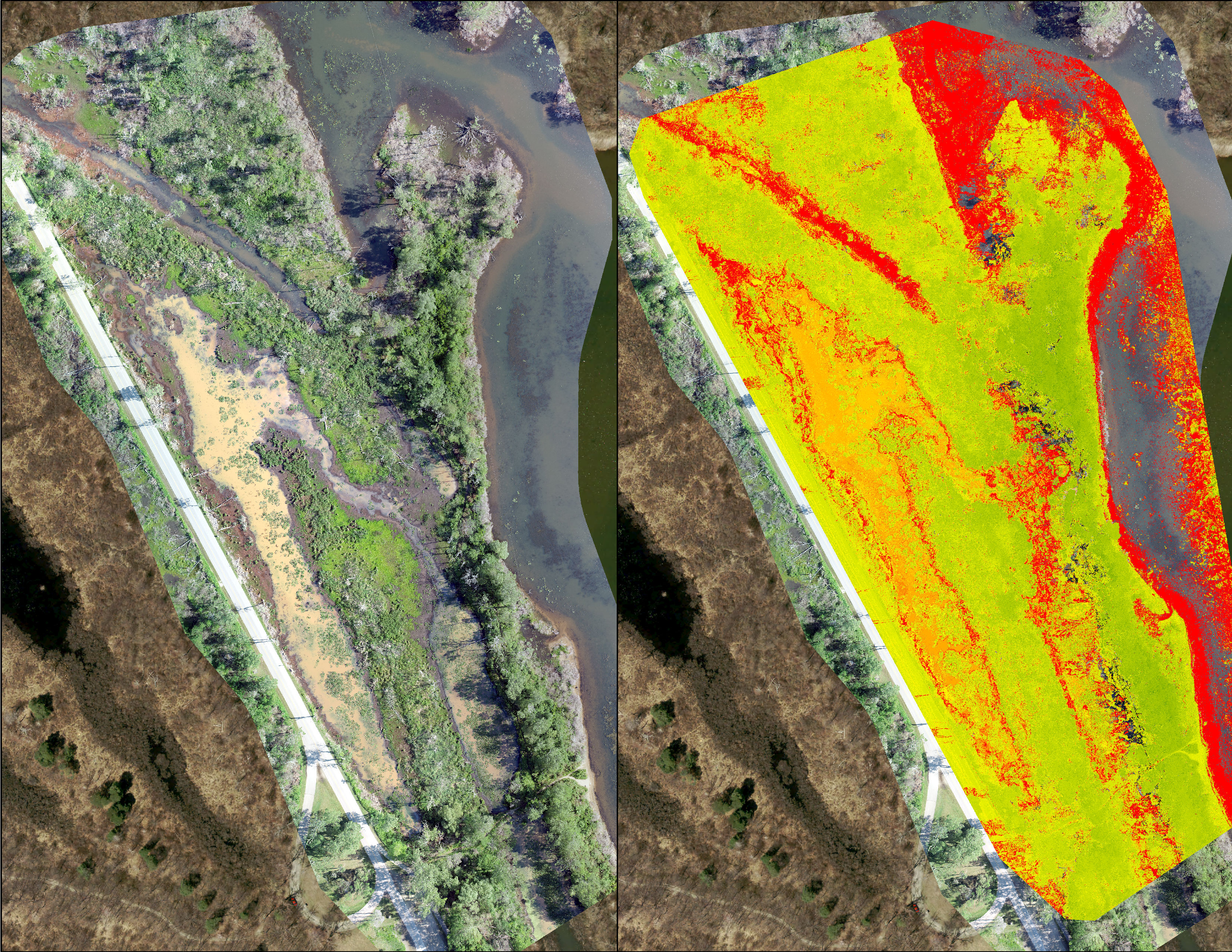
Remote sensing via drone has unique benefits when applied to wetland restoration. The drone has the ability to reach areas deep in the wetland that are difficult to access on foot, which can be advantageous for numerous reasons including habitat assessments as well as plant identification. In a similar fashion to the shoreline, the drone can also generate photomosaic images in high resolution that create a visual catalogue of change over time in response to restoration efforts. The drone can also be fitted with an additional multispectral camera, which by only collecting certain wavelengths of light, allows for the evaluation of a plant’s photosynthetic activity. This information can be used to more accurately treat stands of invasive plants that need to be removed, as well as ensure the health and protection of valuable native species.